
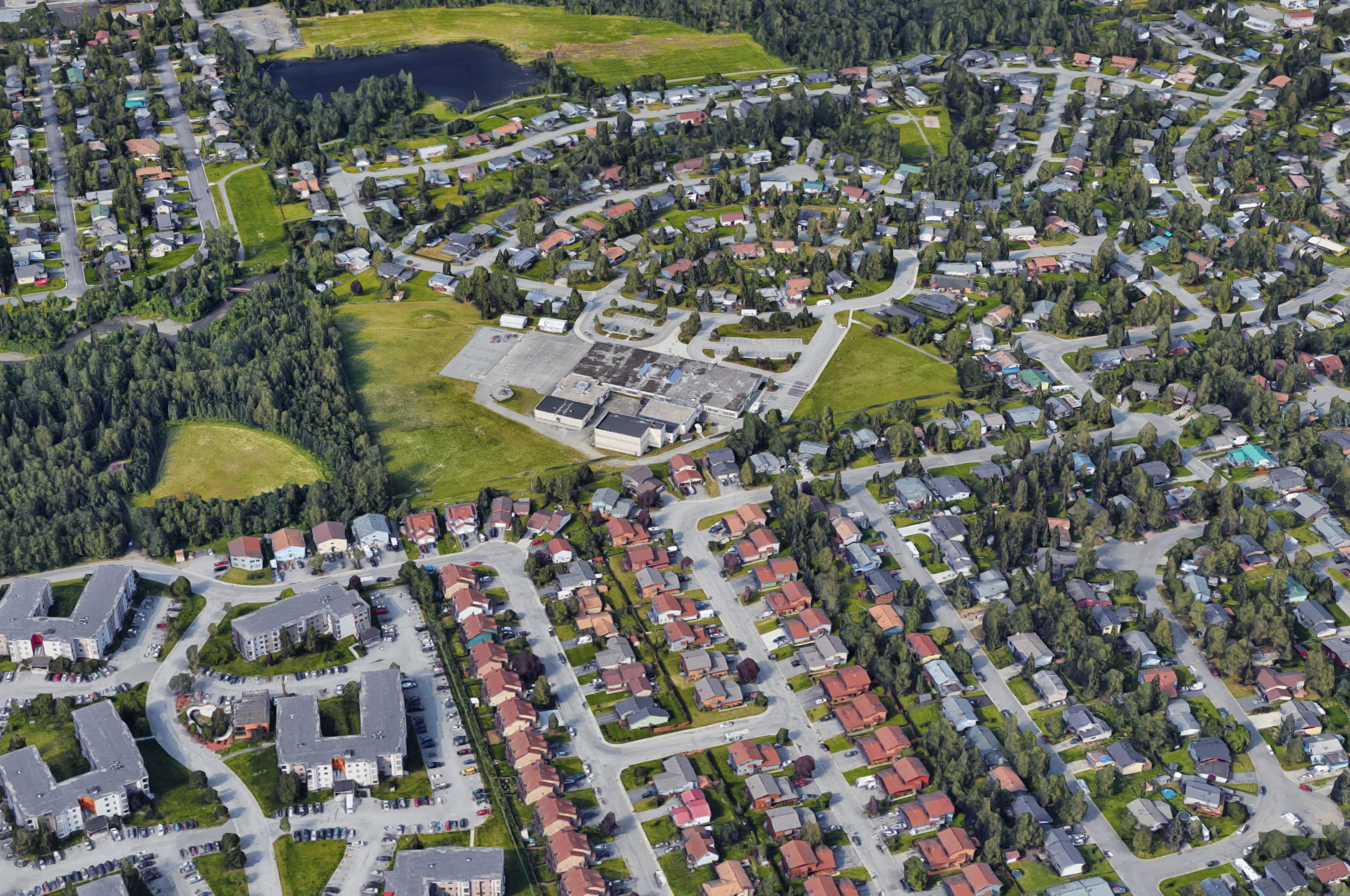
A four-lane death road?
One of many such roads, this stretch of Lake Otis Parkway needs significant improvement, not more lanes
A recent article from Strong Towns highlighted a list of trends that should disappear from our cities, permanently. While several of them are very relevant to Anchorage, there was one in particular that struck a chord with me: four-lane death roads.
Anchorage has a vast array of stroads but the four-lane death road is like the final boss of stroads, a narrow roadway that has somehow been converted into four lanes at the expense of safety, walkability and any semblance of aesthetic value.
While I’d like to address them all, and maybe I’ll get to them in future installments, I’m going to stay in my own lane (pun intended) and write about a four-lane death road that I know, personally.
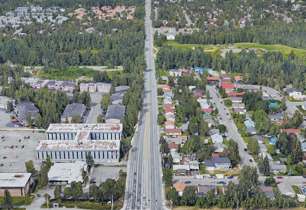
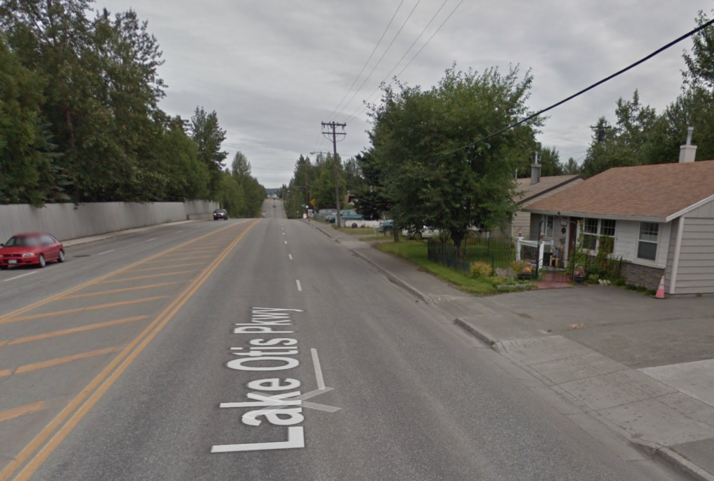
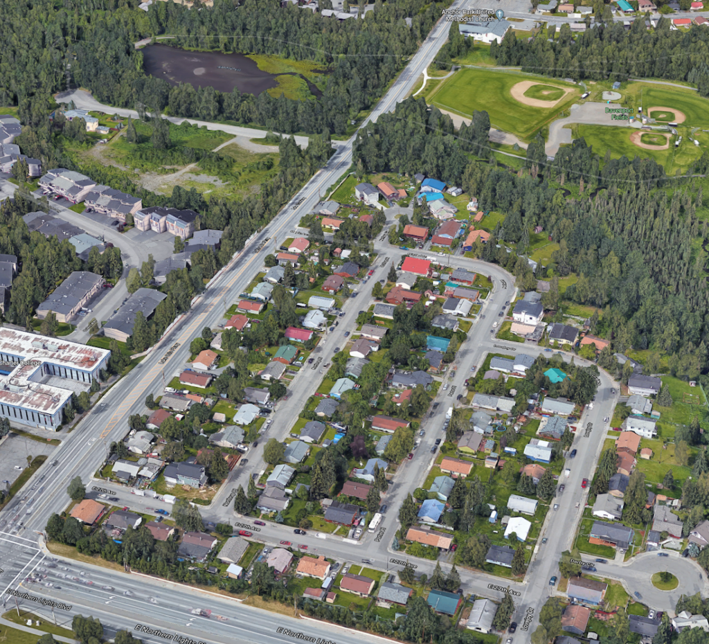
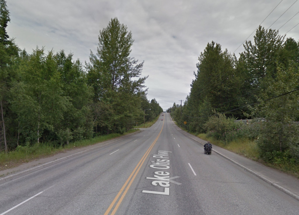
Lake Otis Parkway – The last mile (between N. Lights and Debarr).
Auxillary corridor
At the expense of 3 neighborhoods and 34 homes with direct frontage, this stretch of road has become an auxiliary corridor for outbound commuter traffic seeking a quicker route out of Anchorage while attempting to avoid potential traffic jams on the primary arteries. This results in high speeds, frequent collisions and decreased property values for homes along this road. The current speed limit is 35mph, the average speed is significantly higher and not because people are just reckless but the very nature of the roadway encourages it.
During peak traffic hours, the line at the stoplight (E 20th Avenue) can be quite long, on the Northbound side. Some frustrated motorists are tempted to use the right-hand turn lane to cut to the front of the line and either make a dangerous maneuver to go straight through the intersection or proceed to cut across the neighborhood via E 20th Avenue, usually at high speeds.
Walkability, and access to community resources
Most of this section of the road (technically) has sidewalks on both sides but they’re very narrow and the high speeds of vehicle traffic with no barrier make using them unpleasant at best and unthinkable for families with small children. In the wintertime, they’re nothing short of being an unnecessary risk and seldom used by anyone other than the bravest of souls and that’s when they’re actually cleared of snow.
This area has a high level of bike ridership and that’s great but this road needs bicycle lanes. The Anchor Park neighborhood has no safe access to the park and trail system except using the roadway or sidewalks which may be acceptable for some determined adults but anyone with small children would be averse to using them.
What can we do to fix this?
This is a complex issue since the death of the H2H project several years ago. While there are some primary arteries of outbound commuter traffic, it remains a free-for-all with traffic flow filtering out through a number of roads to access the highway. Some have suggested adding more lanes to this road, which I think shows a complete lack of planning and sets the precedent for our city to become a grid of high-speed thoroughfares. Improvements should be made to improve the flow of dedicated corridors and this road should be reduced to two lanes with bicycle lanes on either side and sidewalks should be widened by at least 2 feet.
This change would restore property values and desirability for the 34 homes directly on this road and improve desirability for the vacant lots on the West side of the street for new development.
As for the stoplight at Lake Otis and E 20th Avenue, I should leave that to traffic engineers but considering the frequency of collisions here, I think the light should be removed and replaced with a roundabout or maybe even just a four-way stop.
The safety conditions of this road are probably similar to dozens of roads across the city. If you live on such a road, consider what could be done to improve it and start a discussion with your neighbors and your community council.
My observation is that the bus no longer runs down this dangerous part of Lake Otis. Since the no.13 was axed, getting from Airport Heights to the University district is convoluted via bus. I was amazed when the city cut that route and did not put any other bus down Lake Otis.